Play Montana Madness to help name Montana’s Best Best Place.
Will it be Fort Benton or First Peoples Buffalo Jump? Voting to name the champion ends Sunday, April 5.
For more stories of places, purchase A History of Montana in 101 Places.
1. Three Forks of the Missouri, Gallatin County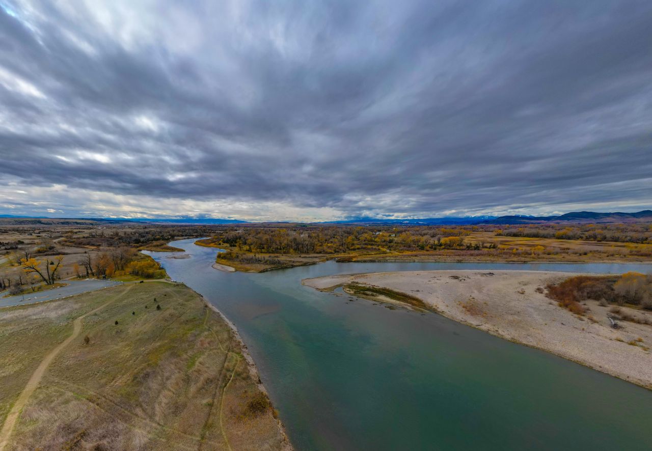
Along major intertribal trade and travel routes, the headwaters of the Missouri was a confluence of people as well as rivers, where generations of Native peoples and later, early explorers and trappers, camped. On July 27, 1805, Meriwether Lewis climbed the limestone cliff overlooking the Three Forks of the Missouri. Noting the lofty mountains and sweeping plains, Lewis realized that the panorama below him represented “an essential point in the geography” of the West.
2. Going-to-the-Sun Road, Glacier National Park, Glacier County 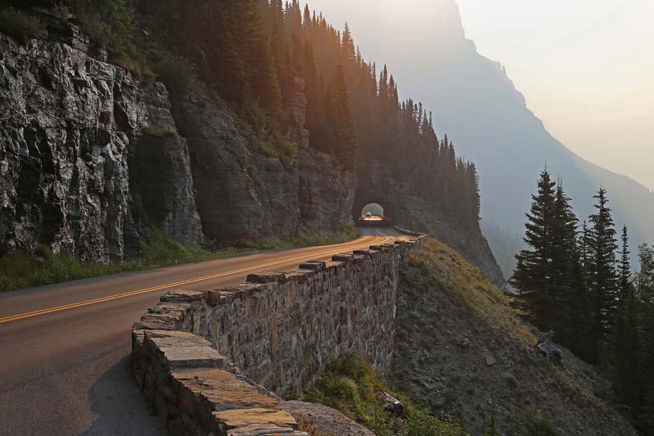 Glacier National Park’s fifty-mile-long Going-to-the-Sun Road is known for its breathtaking views. Congress appropriated the first funds to build the “Transmountain Highway” in 1921. Constructing a road over such mountainous terrain presented a variety of unique challenges including sheer cliffs, a short construction season, and sixty-foot snow drifts. More than ten years later the first automobile crossed the park’s new Transmountain Highway in October 1932.
3. Little Bighorn Battlefield National Monument/Battle of Greasy Grass, Big Horn County 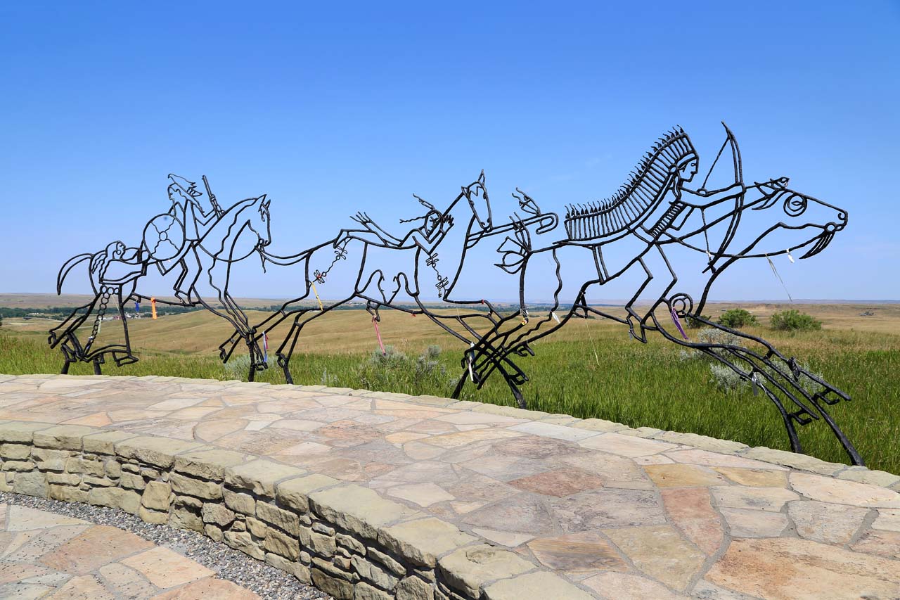 In 1876–1877, the US military targeted the Lakota (Sioux), Tsetsėhesėstȧhase naa Suhtaio (Northern Cheyenne), and Hinono'ei (Arapaho), who remained on unceded hunting grounds rather than moving to reservations. The tribes fought back, most famously winning a battle at Little Bighorn against Lieutenant Colonel George Armstrong Custer and his troops on June 25–26, 1876. Custer’s name became a rallying cry for those seeking to avenge the rout.
4. Fort Benton National Historic Landmark, Choteau County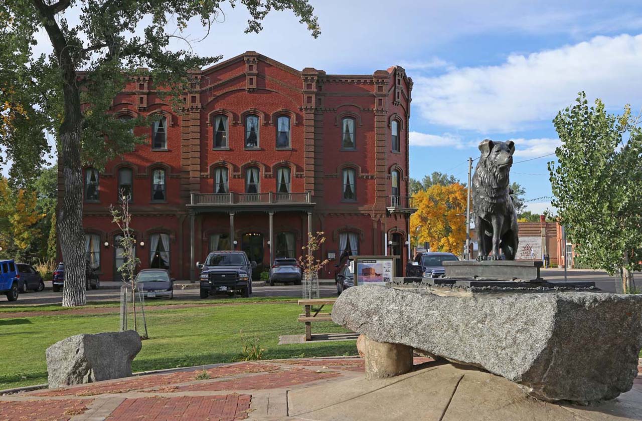
Founded in 1846 as the fur trade transitioned from beaver pelts to buffalo robes, Fort Benton served as a trading post, military fort, and center for the distribution of Indian annuities. It was also the head of navigation on the Missouri River, where the first steamboat arrived in 1860. Fort Benton remained the region’s unchallenged freighting and transportation hub until transcontinental railroads reached Montana in the early 1880s and ended steamboat travel.
5. Fort Peck Dam, Valley and McCone Counties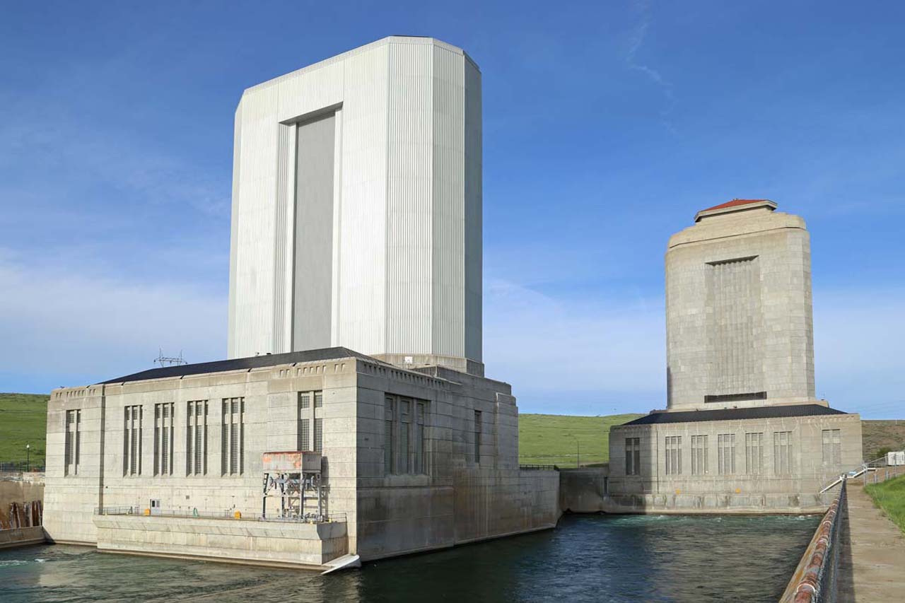
At two-hundred-and-fifty feet high and four miles long, Fort Peck is the largest hydraulically filled dam in the United States. Its construction brought much needed work to tens of thousands of unemployed Americans during the Great Depression, and it continues to provide essential flood control, improved navigation, hydroelectric power, water-quality management, and recreational resources for the Upper Missouri River region.
6. Bannack State Park, Beaverhead County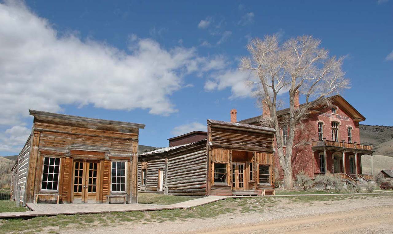 Hopeful miners flocked to Grasshopper Creek in 1862, and Bannack, Montana’s first boom town, sprang to life. Briefly named Montana’s territorial capital, Bannack became a near ghost town after gold was discovered at Virginia City. Quartz mining rebounded in the 1870s, and Bannack served as the Beaverhead County seat until 1881. In 1954, the State of Montana acquired most of the town and it became a state park.
7. First Peoples Buffalo Jump State Park, Ulm, Cascade County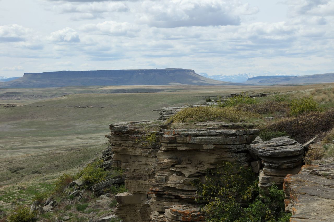
One of the oldest and most intact bison jumps in North America, the National Historic Landmark First Peoples Buffalo Jump exemplifies a communal bison kill site. Before acquiring horses in the 1700s, Indigenous peoples living on the northern plains hunted in groups, on foot. They took advantage of the terrain around them—including areas they turned into “buffalo jumps”—to help them harvest the bison on which they depended for survival.
8. Anselmo Mine, Butte, Silver Bow County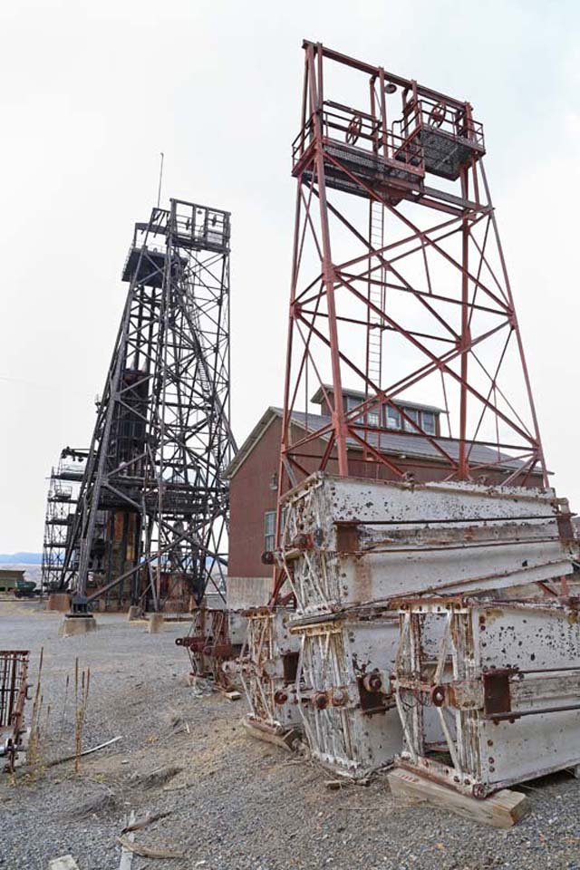
The most intact mine yard left on the Butte Hill, the Anselmo embodies the complexity of extracting ore from deep underground. GrantKohrs.jpgA small silver mine in 1887, it grew into a two-hundred-man operation focused on copper, zinc, and silver in the 1920s. The Anaconda Company acquired full control over the mine in 1926 and employed up to eight-hundred people in the yard and underground workings, some as far down as 4,301 feet.
9. Grant-Kohrs Ranch, Powell County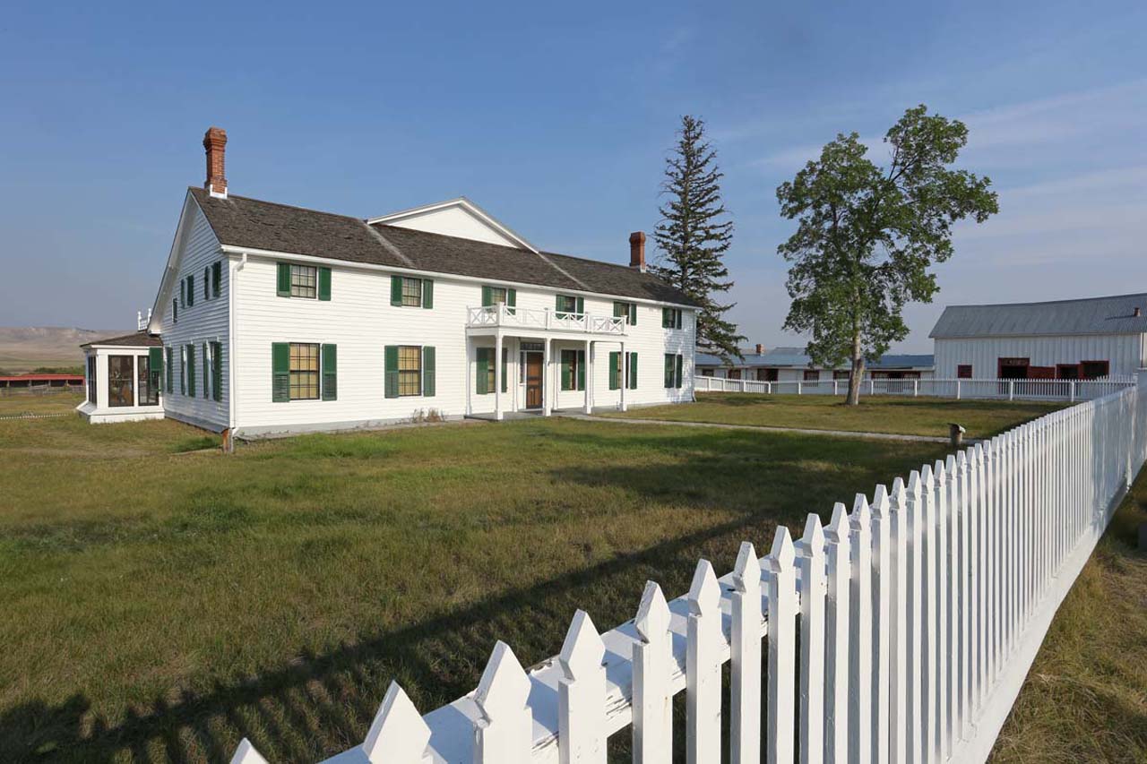
Johnny Grant, a French-Canadian Métis, established the ranch, trailing the first cattle into the Deer Lodge Valley in 1857. German butcher Conrad Kohrs purchased the ranch in 1866. He and his half-brother John Bielenberg ultimately built a huge stock-raising operation. Now a national park, the ranch is a “virtual time machine to America's western cattle ranching heritage, spanning the end of the fur trade through modern, mechanized feedlot operations.”
10. Charles M. Russell Home and Studio, Great Falls, Cascade County Charlie Russell, Montana’s most beloved artist, and his wife Nancy built their modest frame house in Great Falls in 1900. Three years later, they constructed Charlie’s log studio. Nancy noted that Charlie “loved that . . . building more than any other place on earth and never finished a painting anywhere else.”
11. CSKT Bison Range, Flathead Reservation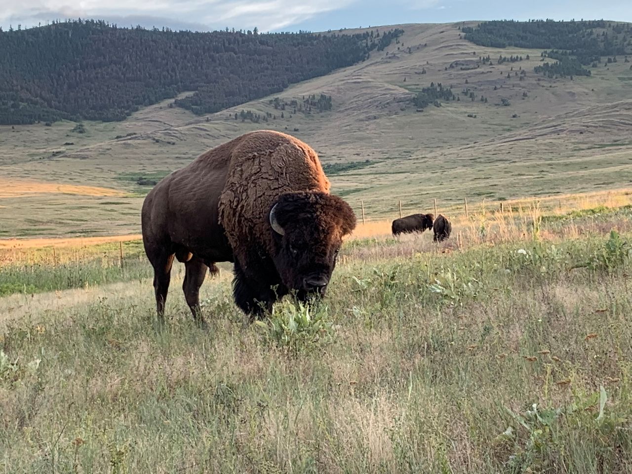
A Ql̓ispé (Pend d’Oreille) man brought six buffalo calves onto the Flathead Reservation in the 1870s. The herd grew to around eight hundred head. However, in 1908, U.S. government policies forced the roundup and sale of the bison. Then the federal government took 18,766 acres of the Flathead Reservation to create the National Bison Range, purchasing some of the same buffalo to populate the preserve. The Confederated Salish and Kootenai Tribes now manage the Bison Range.
12. Pictograph Cave State Park, Billings, Yellowstone County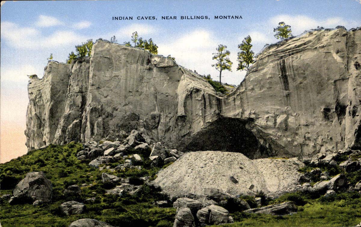 Pictograph, Middle, and Ghost Caves are exceptional for the rare preservation of perishable items and for their stunning art. Early inhabitants painted more than one hundred images on the walls, including one more than two-thousand years old. Artifacts offer evidence of the extensive Indigenous trade network. They include the fragment of a 1,370-year-old coiled basket, which resembles those made in the Great Basin, and a thong necklace strung with Pacific shell beads.
13. Bearcreek, Carbon County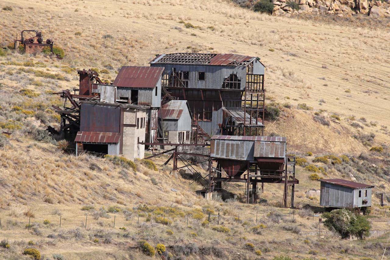
A coal-mining town settled by immigrants from across Europe, Bearcreek prospered from 1905 to 1943. Then, on February 27, 1943, the mine’s inadequate ventilation, a lack of rock-dusting equipment to control coal dust, and open-flame carbide headlamps proved deadly. After methane gas exploded in the Smith Mine shaft number 3, seventy-four miners (and later, one rescuer) died in Montana’s worst coal mining disaster, and Bearcreek became a near ghost town.
14. Lewis and Clark Caverns State Park, Jefferson County Lewis and Clark Caverns, one of the largest and most remarkable caves in the Northern Rockies, became Montana’s first state park in 1937. Members of the Civilian Conservation Corps (CCC)—a Depression era jobs program—developed into the site we know today. The CCC cleaned and surveyed the caves, blasted a 538-foot exit tunnel, installed electric lighting, and built an access road, a Rustic-style headquarters building, a visitors’ center, and a stone latrine.
15. Medicine Rocks State Park, Carter County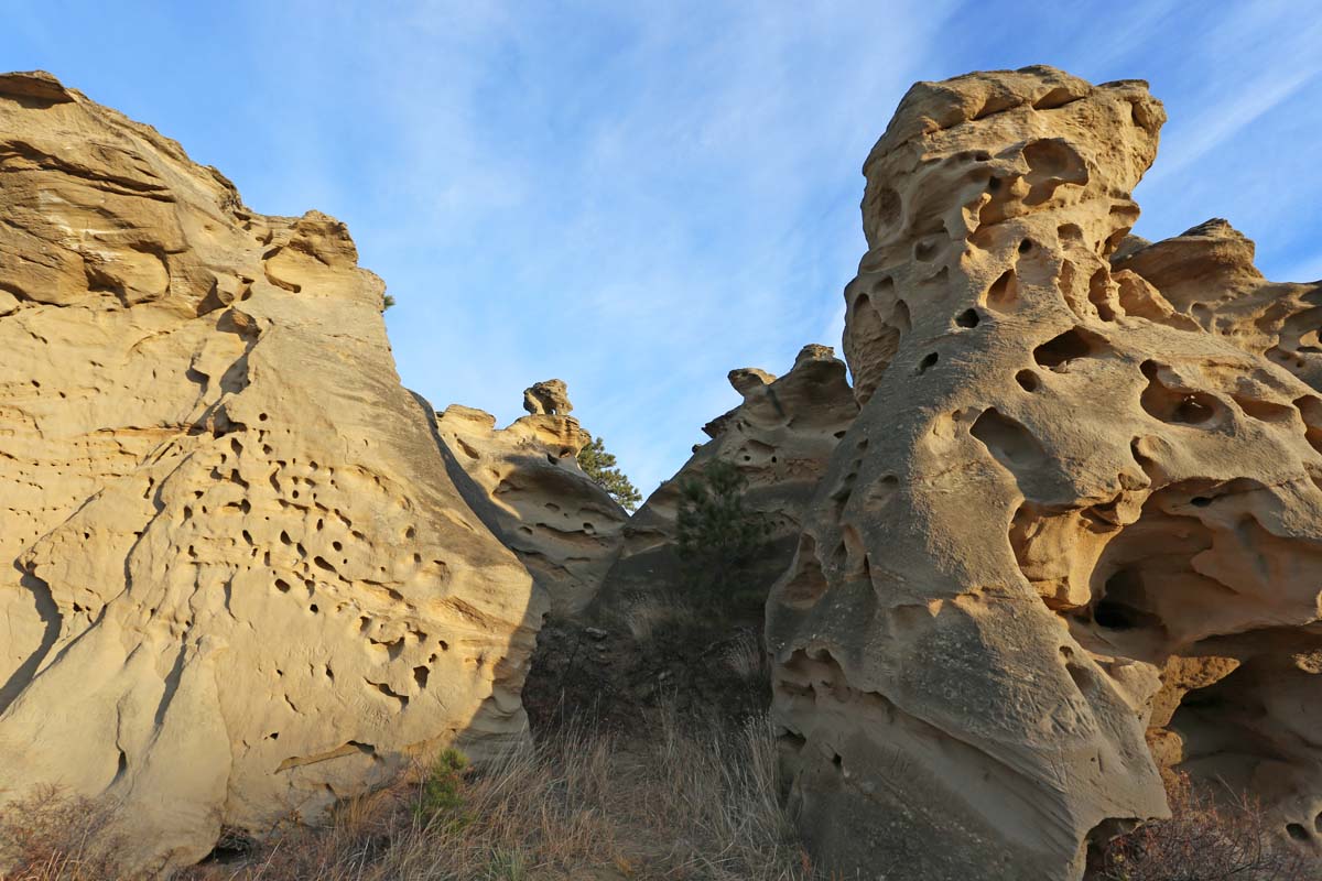
Traveling through southeastern Montana in 1883, young rancher and future US president Theodore Roosevelt was struck by the rock formations, calling the area “as fantastically beautiful a place as I have ever seen.” The sandstone formations display pictographs created by the area’s Indigenous peoples, depicting shield-bearing warriors, “v-necked” humans, and animals. Euro-American settlers also left their mark, carving their names and dates into the rocks.
16. Daniels County Courthouse, Scobey 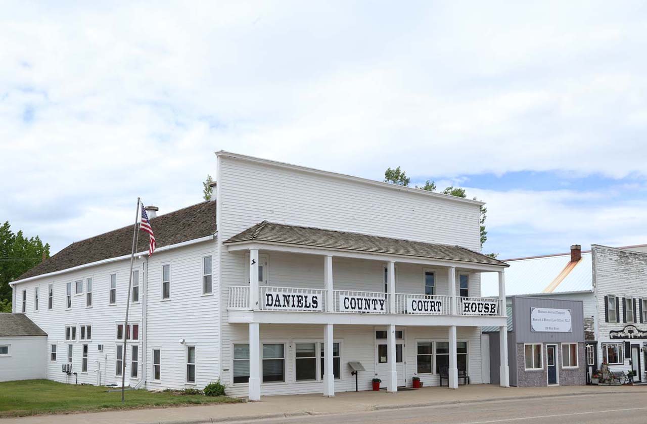 When the first train arrived in Scobey, the two-story, Western False Front–style Commercial Hotel—today the south half of the courthouse—was the new townsite’s largest building. After 1915, gambling, dog fighting, drinking, and prostitution became central to the hotel’s business model. In 1920, county officials purchased the hotel for use as a courthouse. It is Montana’s last functioning false-front courthouse and perhaps the only bordello converted to government use.