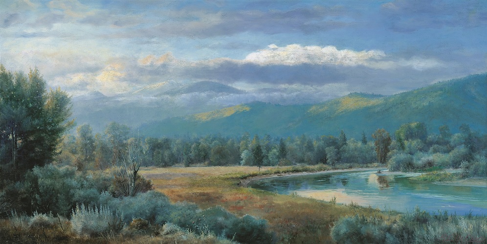
Ralph E. DeCamp, oil on canvas, 1911, 42" x 83"
(Photo by Don Beatty)
Much of the Capitol’s artwork focuses on noteworthy events and individuals from Montana’s history. Artist Ralph DeCamp, on the other hand, chose Montana’s natural beauty to serve as the subject, not just background, of his work. The Bitterroot (now spelled as one word) is a tributary of the Clark Fork River in the southwest corner of the state. Called St. Mary’s River by early Jesuit missionaries, an English translation of the Salish term spetlum (“Place of the bitterroot”) gave the river its permanent name.
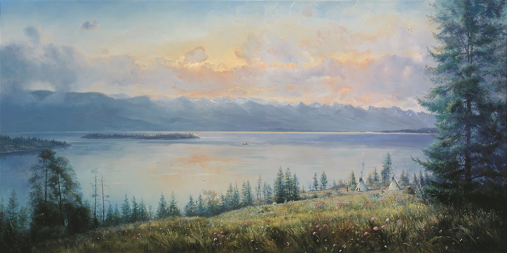
Ralph E. DeCamp, oil on canvas, 1928, 42" x 83"
(Photo by Don Beatty)
DeCamp depicts Flathead Lake, one of the largest freshwater lakes in the country, in its pristine state. Human habitation is subtly indicated by the presence of Indian tepees in the right foreground. The large evergreen on the right not only serves as a visual reminder of the state's flora, but serves compositionally as a repoussoir, or framing device, within the picture.
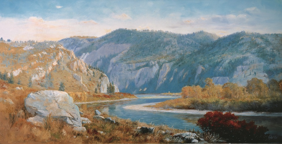
Ralph E. DeCamp, oil on canvas, 1911, 42" x 83"
(Photo by Don Beatty)
DeCamp reduces the bright colors used by the Pedrettis in their rendition of the same general area in order to achieve a softer, more autumnal look. The gates-like effect of the geological formation (so poetically named by Meriwether Lewis in 1805) is difficult to capture in photographs or paintings. DeCamp sought to overcome the difficulty through his composition (the sidelong view of the Missouri River issuing from the narrow space between the cliffs) and by manipulating the light and tone (distinguishing subtly, but convincingly, between the opposing cliffs).
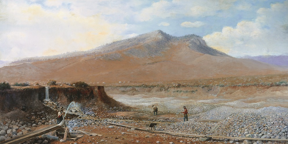
Ralph E. DeCamp, oil on canvas, 1911, 42" x 83"
(Photo by Don Beatty)
One of only two Law Library landscapes that depict the use of the land for industrial purposes, Last Chance returns the Helena area to its pre-urban setting when placer miners originally looked for gold in the Helena Valley. For all his emphasis on the geographical context, most notably Mount Helena towering in the distance, DeCamp does not skimp on practical details. The miner closest to the viewer expertly directs the full force of a hydraulic stream as his cohorts work in the background. The predominance of brown tones differentiates this painting from the others in the Law Library, altering its decorative effect.
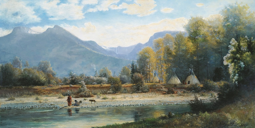
Ralph E. DeCamp, oil on canvas, 1911, 42" x 83"
(Photo by Don Beatty)
Although the mission itself is not visible in the painting, the title refers to the Jesuit mission of St. Ignatius, founded in the foothills of the Mission Mountains in 1854. The appellation “Indian Country” refers to the fact that St. Ignatius was then—and continues to be—part of the Flathead Reservation, home to the Salish, Kootenai, and Pend d’Oreille. DeCamp depicts a scene reminiscent of the pre-encounter period, before the influx of white settlers.
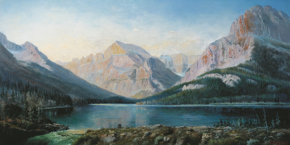
Ralph E. DeCamp, oil on canvas, 1912, 42" x 83"
(Photo by Don Beatty)
A small body of water that feeds larger Lake Sherburne, Lake McDermott (now known as Swiftcurrent Lake) is located near the Grinnell Glacier in the eastern part of Glacier National Park. An acclaimed tourist destination by 1912, this portion of the northern Rocky Mountains became a national park in 1910. In this painting, DeCamp uses snow to highlight the surrounding mountains and draw attention to the geophysical features of glaciation.
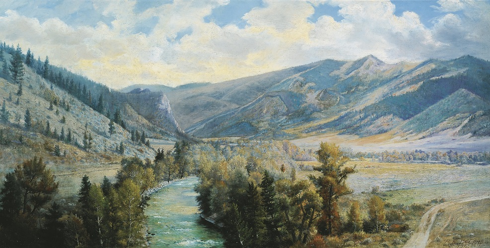
Ralph E. DeCamp, oil on canvas, 1912, 42" x 83"
(Photo by Don Beatty)
The Gallatin refers to the area of southern Montana immediately north of Yellowstone National Park through which the Gallatin River (pictured) flows. Once again, DeCamp chose a spot from which one sees water, mountains, and big sky at the same time. The river in this case is centered, flowing gently toward the viewer. The artist seems to enjoy playing the curve of the tree-lined river against the encircling contour of mountain behind it.
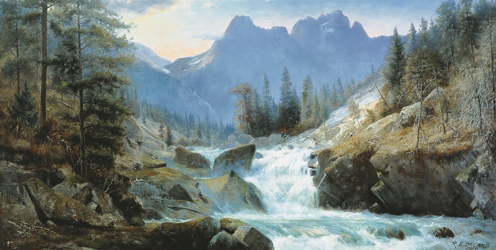
Ralph E. DeCamp, oil on canvas, 1928, 42" x 83"
(Photo by Don Beatty)
The most turbulent of DeCamp’s water scenes, The Rosebud River perhaps succeeds best in expressing the stark, solitary beauty, and potential violence of Montana’s wilderness. The exact site is thought to be just above East Rosebud Lake, west of Red Lodge. Even today, the spot is difficult to access, further confirming the personal quest each site represented to DeCamp.
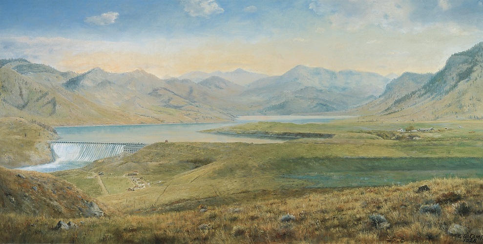
Ralph E. DeCamp, oil on canvas, 1928, 42" x 83"
(Photo by Don Beatty)
By choosing a majestic panoramic view and situating the viewer on a high vantage point overlooking the dam in the distance, DeCamp pays homage to the beauty of the landscape while at the same time carefully depicting details of what was, at the time, one of the finest hydroelectric plants in the country. Holter Dam is located on the Missouri River near Wolf Creek, about forty miles north of Helena, and remains in use.
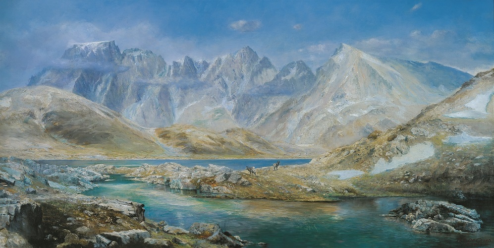
Ralph E. DeCamp, oil on canvas, 1928, 42" x 83"
(Photo by Don Beatty)
Above Timberline is the only one of ten landscape paintings that does not allude to a specific site in its title, although the scene is thought to be one from the Granite Range near the northeastern part of Yellowstone National Park. Trees are noticeably absent, and the craggy peaks are expressive of a colder, loftier elevation.
